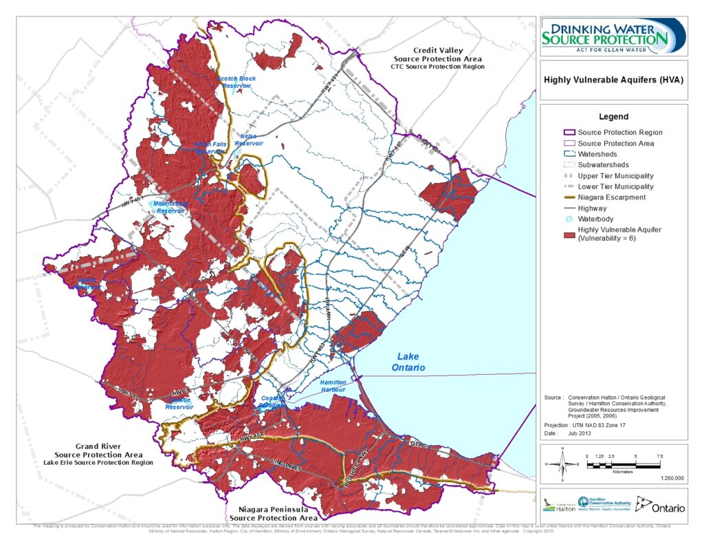
Highly Vulnerable Aquifers (HVAs)
Highly vulnerable aquifers are defined as subsurface, geologic formations that are sources of drinking water, which could relatively easily be impacted by the release of pollutants on the ground surface.
The Intrinsic Susceptibility Index (ISI) method was used to map highly vulnerable aquifers in the Source Protection Region. The factors considered to assess the vulnerability of an aquifer are the depth to the aquifer and to the water table, the properties of the overlying soil and/or rock and the aquifer composition.
A significant portion of the watersheds are highly vulnerable to aquifer contamination. This is primarily due to the conditions above the Niagara Escarpment where the water table is shallow, the overburden is thin and permeable (or absent), and the aquifer is fractured bedrock. The vulnerability of the aquifer decreases in this area only where soils are thicker, such as on moraines and drumlins.
High vulnerability has been mapped in very few locations below the escarpment due to the low permeability characteristics of the shale bedrock and overlying till. Areas of high vulnerability are due to thin permeable soils and a shallow water table.
For the purposes of source protection planning, the areas mapped as highly vulnerable, using the intrinsic susceptibility index method, translated to a vulnerability score of six. This score is used for assessment of risk to drinking water sources from human activity and discussed more on the Drinking Water Threats webpage.